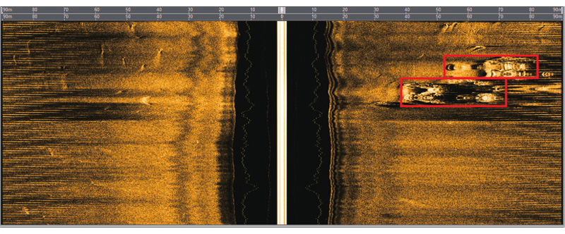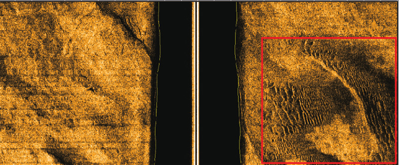


The seabed terrain classification and recognition system is a software suite independently developed by the POET for automatic classification and recognition of common seabed terrain and landforms, including sample classification and recognition training system as well as image display and marking system. The software suite uses machine learning algorithm to classify, recognize and display seabed targets. The system supports standard sonar data format and has a friendly visual interface.
The seabed terrain classification and recognition system is a software suite independently developed by the POET for automatic classification and recognition of common seabed terrain and landforms, including sample classification and recognition training system as well as image display and marking system. The software suite uses machine learning algorithm to classify, recognize and display seabed targets. The system supports standard sonar data format and has a friendly visual interface.
Scientific research
Engineering survey
Mineral exploration
Seafloor sand wave is a common seafloor landform. Its formation and evolution are closely related to the properties of seafloor sediments, regional topographic and geomorphic characteristics and hydrodynamic environment. Therefore, the study of seafloor sand wave has very important theoretical significance. In addition, submarine sand waves also threaten the safety of submarine pipelines and submarine cables, and submarine placers also contain rich metal mineral resources. Therefore, the study of submarine sand waves also has very important engineering significance and economic value.

Artificial fish reefs are fixed objects artificially set on the seafloor, which are suitable for animal clusters and habitats. They are important measures to protect, proliferate, increase the catch and improve the balance of the ecosystem.
